Brownfields Program
What are Brownfields?
A Brownfield is defined as “a property, the expansion, redevelopment, or reuse of which may be complicated by the presence or potential presence of a hazardous substance, pollutant, or contaminant”. Brownfields can vary but are often properties that are abandoned, blighted, or underused. Examples can include: landfills, abandoned buildings, old schools, or abandoned gas stations.
Why are Brownfields a Priority for Santa Ana?
Environmental quality has always been and always will be a high priority for the Pueblo. Brownfields specifically have become a priority for the Pueblo for a number of reasons:
1) Over 13 potential brownfields have been in existence for decades and numerous environmental contaminants remain un-mitigated
2) The Pueblo needs more space to expand the business, government and housing sectors and many of these buildings are impeding those new projects
3) 64,000 acres of historical land were recently purchased and have a number of potential brownfields impeding the use of buildings, as well as reuse and redevelopment of the land, compounding the brownfields problem, and
4) The community is not aware of all the potential hazards of brownfields and there are no coordinated land use controls or institutional controls program in place to protect them.
How does this Program benefit Santa Ana?
- Healthier neighborhoods
- Improve quality of life
- Historic preservation
- Environmental benefits & open spaces
- Cleaner community
- Ecological restoration
- Economic development
- Revitalization of blighted areas
- And many more…
What can you do?
You can help with the identification of potential brownfields or provide supplemental pictures or information you may find important we add. Once this information is compiled, you, as a community member, can provide your input to prioritize these sites for clean-up.
Program Background
The Santa Ana Department of Natural Resources was awarded the EPA 128a Brownfields Response Program grant in 2019 that funded the Environmental Division Brownfields Program. Being a fairly new program we are working to identify and inventory the current brownfield properties across the Pueblo. This is an ongoing process that allows us to begin prioritizing sites for assessment and eventual clean-up.
Brownfields Feedback
Click above to provide feedback on prioritizing identified sites and/or report potential brownfield sites
Identified Potential Brownfields
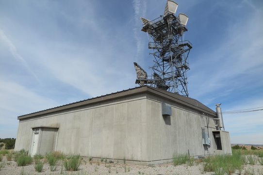
- The site is currently not in use. It is a former communication site permitted by the BLM to American Telephone and Telegraph Company as a radio relay station. AT&T (then, conveyed to American Tower in 2000) leased the property from 1964 until 2014. There was also a BLM granted ROW for a telephone/graph line on July 27th, 1978.
- Possible hazards: asbestos-containing materials, underground storage tank
- Risk level: low-moderate
- Approximate site size: 0.41 acres
- Action taken: Phase I Environmental Site Assessment completed by Keres Consulting; Ground penetrating radar performed by Southwest Geophysical Consulting, LLC for underground storage tank; Asbestos and Lead Sampling performed by ACME Environmental*
- Institutional control: restricted access
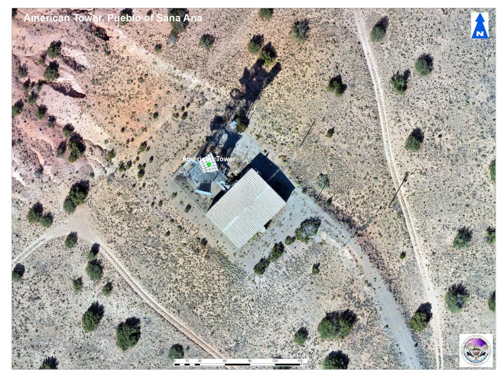
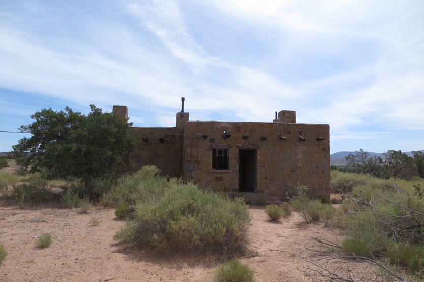
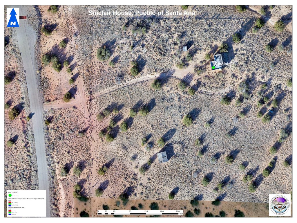
- Property contains a main house, guest house, bomb shelter
- Possible hazards: asbestos-containing materials, lead-based paint, underground storage tank
- risk level: low-moderate
- Approximate site size: 1 acre
- Action taken: Main house, garage, and guest house all tested for asbestos-containing materials
- Institutional control: restricted access
- Property contains a main house, scattered debris
- Possible hazards: asbestos-containing materials, lead-based paint
- Risk level: low
- Approximate site size: 1 acre
- Action taken: Phase I ESA planned for 2025
- Institutional control: restricted access
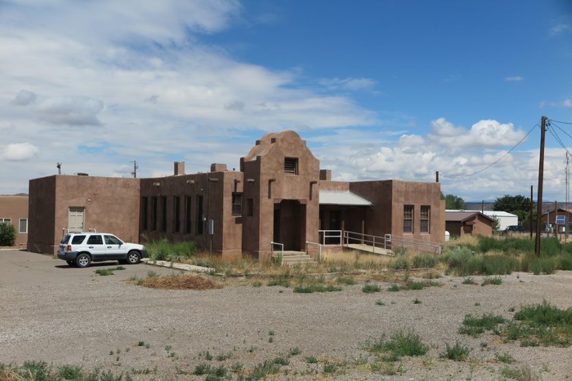
- Old day school that was later used as office space
- Possible hazards: lead-based paint, asbestos-containing materials
- Risk level: low
- Approximate site size: 0.29 acres
- Action taken: priority site, Phase I Environmental Site Assessment conducted in 2022; Phase II Environmental Site Assessment conducted in 2023; two rounds of supplemental sampling conducted in 2024 in main structure and outbuildings; abatement activities planned for 2025
- Institutional control: restricted access
- Picnic area is closed to the public
- Possible hazards: lead-based paint, asbestos-containing materials
- Risk level: low
- Approximate site size: 0.5 acres
- Action taken: lead and asbestos sampling
- Institutional control: restricted access
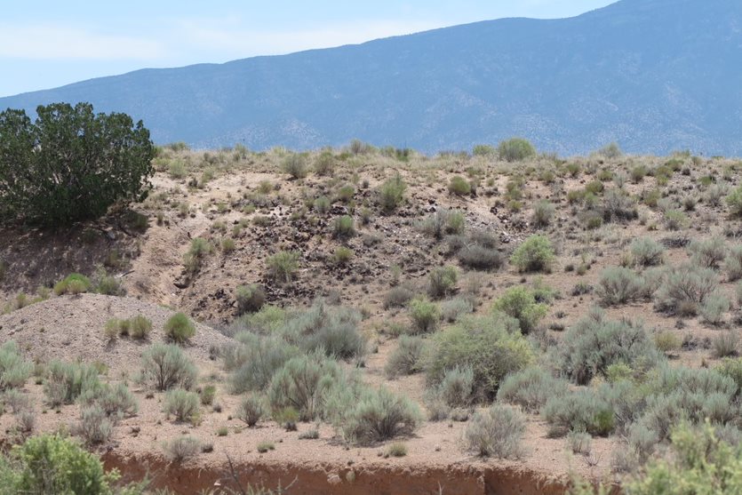
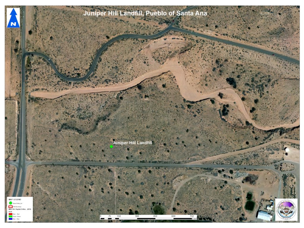
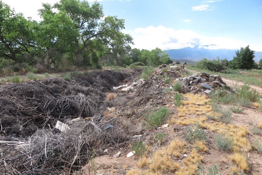
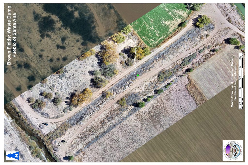
- Past landfill that has been filled in and no longer being used
- Possible hazards: environmental contamination from household hazardous waste, trash layers are becoming exposed and is in proximity to an arroyo
- Risk level: low-moderate
- Approximate site size: 17 acres
- Action taken: priority site, Phase I Environmental Site Assessment conducted in 2022
- Institutional control: fencing, Tribal Solid Waste Code
- Past ranching property with two houses, a storage structure, barn, and corrals
- Possible hazards: lead-based paint, asbestos-containing materials, majority of past dumpsite cleaned up, possible abandoned septic tank
- Risk level: low
- Approximate site size: 2.62 acres
- Action taken: Phase I ESA planned for 2025
- Institutional control: restricted access
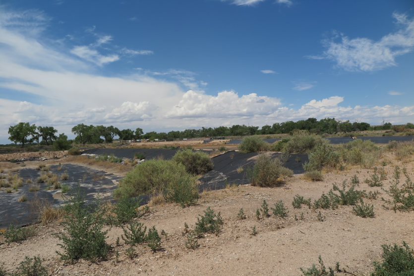
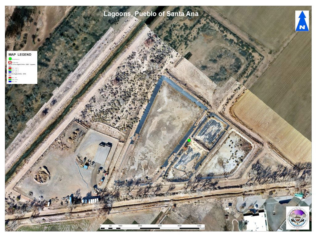
- Water treatment lagoons no longer being used
- Risk level: low
- Approximate site size: 9 acres
- Action taken: priority site, Phase I Environmental Site Assessment conducted in 2023
- Institutional control: restricted access
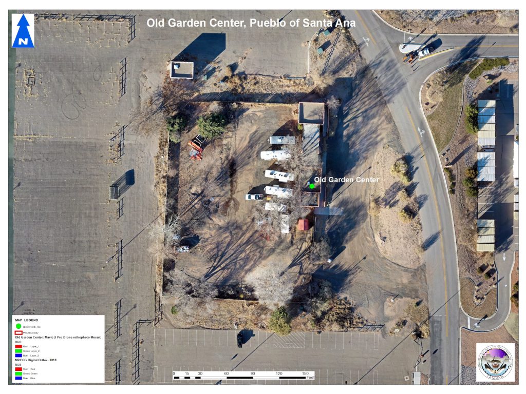
- Past garden center that was used for a law firm office
- Risk level: low
- Approximate site size: 1.52 acres
- Action taken: N/A
- Institutional control: restricted access
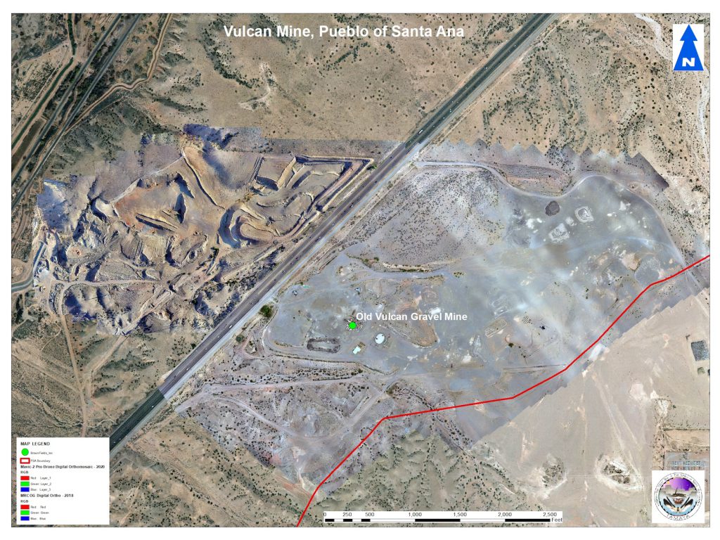
- Mine site is adjacent to current mining activities and business operations of Vulcan
- Risk level: low
- Approximate site size: 366 acres (includes active mining area)
- Action taken: Reclamation actions planned (11/19/2021)
- Institutional control: restricted access
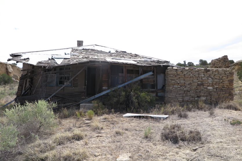
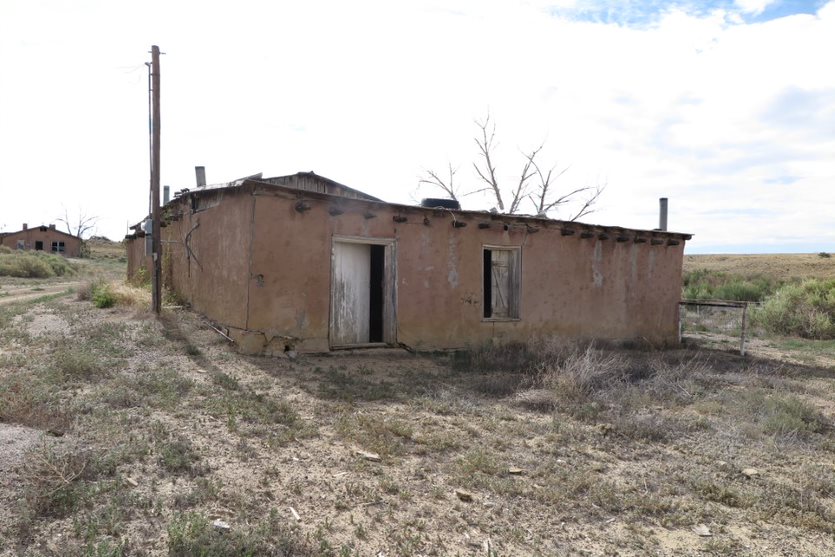
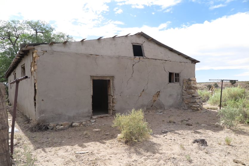
- Past ranching property with one main house and corral
- Possible hazards: lead-based paint, asbestos-containing materials, collapsing building, exposed well, possible abandoned septic tank
- Risk level: low
- Approximate site size: 0.71 acres
- Action taken: Phase I ESA conducted 5/2025, Phase II ESA completed 9/2025- no asbestos-containing materials or lead-based paint identified at the property
- Institutional control: restricted access
- Past dumpsite for greenwaste, house hold trash, building materials
- Possible hazards: hazardous house hold waste in proximity to active ditch, asbestos
- Risk level: low-moderate
- Approximate site size: 1.32 acres
- Action taken: priority site, Phase I Environmental Site Assessment conducted in 2023; alternative clean-up actions planned for the future
- Institutional control: Tribal Solid Waste Code
- Past ranch property with a main house, storage shed, and corral with attached shed
- Possible hazards: lead-based paint, asbestos-containing materials, possible abandoned septic tank
- Risk level: low
- Approximate site size: 0.32 acres
- Action taken: N/A
- Institutional control: restricted access
*Risk level was determined for each site based on the proximity to the inhabited community, water resources, and the extent of any identified hazards as well as their potential impact on the environment and human, animal, or plant life.
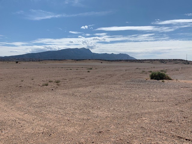
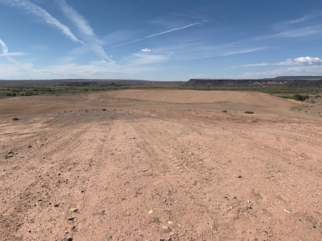
Site Photos
Contact Brownfields Team
Tara Weston, Environmental Program Manager, tara.weston@santaana-nsn.gov
Victor Lopez, Environmental Technician I, victor.lopez@santaana-nsn.gov